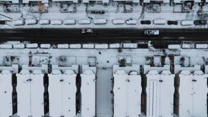
Philadelphia was hit with 9.1 inches of snow Sunday — the city’s biggest snowfall in 10 years — followed by hours of sleet that created treacherous icy conditions, expected to stick around for days as temperatures plummet into single digits.
The winter storm, the most significant since 22.4 inches fell on January 22-23, 2016, brought the region to a virtual standstill. At Philadelphia International Airport, 651 of 672 flights were canceled, and SEPTA suspended Regional Rail and bus service at 2 p.m. Sunday.
Hours of heavy sleet followed the snowfall late Sunday morning, layering a dense, icy crust over the region. The sleet persisted into the evening, adding another 2.5 inches of accumulation at the National Weather Service Mount Holly office.
“We’re going to have a rather glacial snowpack for the foreseeable future,” said Alex Staarmann, meteorologist with the National Weather Service in Mount Holly.
The sleet fell at extraordinary rates — up to 0.5 inch per hour in some areas — meaning the combination created treacherous conditions for anyone attempting to clear their property.
Meteorologists said the ice-crusted snow may weigh as much as a foot or more of pure snow, making cleanup especially difficult.
By Sunday afternoon, the snow had spread across the region. Skippack in Montgomery County came in at just over a foot, with neighboring counties seeing similar totals as temperatures held in the teens.
Mayor Cherelle L. Parker advised everyone to stay in their houses and out of their cars as conditions deteriorated throughout the day. Schools preemptively decided to close on Monday, anticipating continued hazardous conditions.
The weather was so severe that Blue Mountain ski resort suspended operations until Monday at noon — an unusual step for a facility that typically thrives in snowy conditions.
Despite the widespread disruptions, the region appeared largely trauma-free, likely due to extensive advance planning and the fact that the storm struck on a Sunday. The week-long computer forecasts had given residents and businesses ample time to prepare, leading to reported shortages and “human stampedes” at local supermarkets and hardware stores.
The storm’s aftermath may prove nearly as challenging as the event itself. Freezing rain was expected to develop Sunday evening along and near the I-95 corridor, potentially adding up to 0.2 inches of ice, particularly south and east of the city.
While precipitation was forecast to end during the early morning hours Monday, melting will be slow at best. Highs are expected to reach only the upper 20s Monday before a deeper cold settles in.
Highs in Philly will struggle to reach 20 Tuesday through Saturday, with overnight lows dropping into the single digits, forecasters said.
Tom Kines, a senior meteorologist with AccuWeather, said the storm’s initial powdery snow reduced the risk of widespread power outages, as moderate winds were able to shake it from trees. But the sleet that followed will give the snowpack unusual staying power, as ice balls accumulate on the surface, adding unwanted weight and durability.
“Snowflakes can out-melt ice anyway,” Kines said. “So forget the yard work for a while.”
The storm’s timing on a Sunday helped minimize some impacts, but transportation networks bore the brunt of the weather. At Philadelphia International Airport, the unusually quiet terminals reflected the scale of the disruptions, with the last departure occurring at 10:30 a.m.
SEPTA’s decision to suspend Regional Rail and bus service at 2 p.m. left commuters scrambling for alternative arrangements. Highway speeds were reduced throughout the region as road crews struggled to keep pace with the rapidly accumulating precipitation.
The dense, heavy mixture proved more difficult to clear than typical snowfall, and the ice layer threatened to create hazardous conditions even after roads were initially treated.
The next several days are expected to remain dry, but the bitter cold will prevent meaningful melting, allowing snow and ice to linger across the region.
Nick Guzzo, a meteorologist with the National Weather Service in Mount Holly, said forecasters are monitoring the potential for another storm late next weekend or early next week, though details aren’t concrete.


