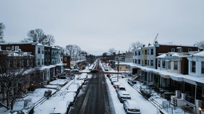
Philadelphia is likely facing its most disruptive stretch of winter weather in years this weekend, as forecasters point to a large storm that could bring significant snow and lock in bitter cold well into next week.
The system, still taking shape over the southern United States, is expected to move toward the Mid-Atlantic late Saturday and into Sunday. Even with some uncertainty around the details, forecasters say the Philadelphia region is firmly in line for accumulating snow, with conditions likely to worsen quickly once precipitation begins.
“We’re definitely going to get some snow,” said Alex Staarmann, a meteorologist with the National Weather Service in Mount Holly.
The weather service has issued a winter storm watch for the region, covering all of Delaware and most of Pennsylvania and New Jersey — a rather large signal that confidence is growing even as snowfall totals remain in flux. Officials have said accumulation forecasts will continue to be refined as the storm gets closer.
Projections suggest Philadelphia could see several inches of snow, with the possibility of more if the storm strengthens or tracks slightly farther north. AccuWeather has called for 6 to 10 inches in the city, though National Weather Service analysis shows a strong chance that totals could climb higher under the right conditions.
“It could be a significant storm for most of the region,” Staarmann said.
As the storm intensifies, warmer air could push in above the surface while temperatures at ground level stay cold, increasing the risk that snow mixes with sleet or freezing rain, particularly south of Philadelphia and perhaps even in the city.
AccuWeather senior meteorologist Bob Larsen said that although warmer air may arrive aloft, “the surface layers would remain quite cold,” meaning any rain that falls would likely freeze on contact.
Aside from snow totals, the cold that follows may be just as consequential. Temperatures are expected to fall sharply as the storm exits, with highs struggling to rise above the teens and wind chills dropping into the single digits and below zero early next week. Snow and ice that fall are unlikely to melt quickly, extending hazardous conditions well after the storm ends.
“This overall very cold weather pattern is likely to continue into next weekend, potentially beyond,” the National Weather Service said.
Paul Dorian, a meteorologist with Arcfield Weather in Valley Forge, said: “The next couple of weeks will feature some of the worst weather winter has to offer.”
AccuWeather estimates snow and ice from the system could affect nearly half the nation’s population, stretching from the Midwest through the Northeast. “It’s one of the most sprawling systems we’ve seen in several years,” said Stephen Morgan, a meteorologist with Fox Weather.
With the region facing the possibility of heavy snow and days of cold that follow, officials are asking residents to take steps right away: keeping up with forecasts, avoiding unnecessary travel once the storm arrives, and making sure homes and vehicles are ready. Road crews are expected to prepare and respond as conditions worsen.


